- Home
- About Us
- Our Products
- Handicraft Items
- Home Decorative Items
- Antique Products
- Tripod Lamp Stand
- Telescopes & Binoculars
- Nautical Bell
- Nautical Compass
- Decorative Wall Clock
- Nautical Sextant
- Nautical Lamps
- Nautical Validate
- Astronomy Armillary
- Armor Suit
- Armor Helmet
- Divers Helmet
- Nautical Beam Scale
- Roman Shield
- Walking Stick
- Armour Parts
- Wooden Box
- Key Chain
- Antique Spotlight
- Land Surveying Instruments
- Automatic Level Instrument
- SETL Automatic Level
- SETL Automatic Level AL
- Automatic Level SET AI And DS Series
- Sokkia Automatic Level
- South Automatic Level Instrument
- South NL-32
- Sun Automatic Level
- Bosch Auto Level
- Bosch Gol 26D Auto Level
- Bosch Gol 32D Auto Level
- Geomax Automatic Level
- Geomax ZAL 324
- Geomax ZAL 332
- Pentax Automatic Level
- Pentax AP 324 Auto Level
- Pentax AP 332 Auto Level
- Leica Auto Level
- Topcon AT-B4 Auto Level
- Total Station Machine
- SOKKIA Total Station
- SOKKIA IM 55 Total Station
- SOKKIA IM 52 Total Station
- SOKKIA IM 101 Total Station
- Geomax Total Station
- Geomax Zoom 10 Total Station
- Geomax Zoom 25 Total Station
- Geomax Zoom 40 Total Station
- Geomax Zoom 50 Total Station
- Leica Flexline Total Station
- Leica Flexline TS03 Total Station
- Leica Flexline TS07 Total Station
- Leica Flexline TS10 Total Station
- Topcon Total Station
- Topcon GM 55 Total Station
- Topcon GM 52 Total Station
- Topcon GM 101 Total Station
- South Total Station
- SOUTH N6+ SERES 2’’/5’’
- Vernier Theodolite
- Land Measurement Tools
- Tripod Stand
- Tangent Clinometer
- Telescopic Alidade
- Telescopic Levelling Staves
- Prismatic Compass
- Survey Accessories
- Mirror Stereoscope
- Cross Staff
- Dumpy Level Instrument
- Digital Planimeter
- Line Ranger
- Distance Meter
- Box Sextant
- Brunton Compass
- Suunto PM 5/ 360 PC Clinometer
- Drawing Instrument
- Handheld GPS Device
- Digital Theodolite
- Hand Operated Sieve Shaker
- Test Sieves
- Laboratory Oven
- Ammonia Printing Machine
- Compression Testing Machine
- Vibrating Table
- Rain Gauge
- Digital Rain Gauge
- Digital PH Meter
- Water Current Meter
- Soil Moisture Meter
- Spherical Crown Densiometer
- Brass Handicrafts
- Certificates
- Blogs
- Contact Us
- Sitemap
5 Valuable Roles Of Geomax Total Station In Modern Surveying
- By: Admin

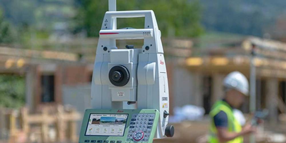
In the realm of modern surveying, technological advancements have revolutionized the way professionals collect accurate spatial data. Among these innovations, the Geomax Total Station stands out as a versatile and indispensable tool. Here are five valuable roles it plays in modern surveying practices:
Precision Measurement:
The Geomax Total Station boasts high-precision measurement capabilities, allowing surveyors to accurately determine distances, angles, and coordinates with minimal error. This precision is essential for tasks ranging from boundary delineation to construction layout, ensuring that projects are executed with utmost accuracy.
Efficient Data Collection:
With its advanced electronic distance measurement (EDM) technology, the Geomax Total Station in Roorkee facilitates rapid data collection across various terrain types. Surveyors can efficiently capture measurements even in challenging environments, streamlining the surveying process and reducing time spent on-site.
Integrated Data Management:
Modern surveying projects often involve vast amounts of spatial data. The Geomax Total Station integrates seamlessly with data management software, allowing surveyors to organize, analyze, and share data effortlessly. This integration enhances collaboration among project stakeholders and enables informed decision-making throughout the surveying process.
Versatile Applications:
From topographic mapping to construction staking, the Geomax Total Station offers versatile applications that cater to diverse surveying needs. Its adaptability makes it suitable for a wide range of industries, including engineering, land development, and environmental management, making it a valuable asset for professionals across various sectors.
Enhanced Productivity:
By automating repetitive surveying tasks and reducing the need for manual calculations, the Geomax Total Station from Geomax Total Station Wholesale Supplier in India, like Jafri Survey Instruments, significantly boosts productivity in the field. Surveyors can accomplish more in less time, leading to cost savings for clients and improved project efficiency.
The Geomax Total Station plays several valuable roles in modern surveying, ranging from precision measurement to enhanced productivity. Its advanced features, efficient data collection capabilities, and versatility make it an indispensable tool for professionals seeking accurate and reliable spatial data. By leveraging the power of technology, surveyors can elevate their workflows and deliver superior results in today's dynamic surveying landscape.

